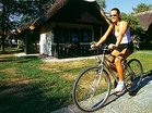
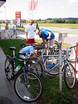
SloveniaHolidays.com > Activities > Cycling > Road cycling
Road cycling Slovenia - Cycling
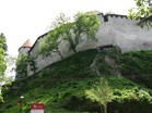
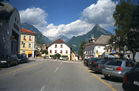
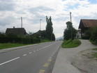
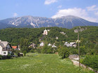
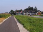
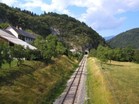
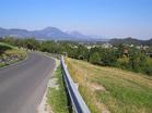
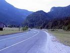
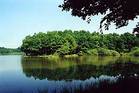
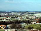
Road biking route Blejski grad - Grad Kamen
Path length: 11.5 km
Duration of the drive: 0:45 h
Starting point: Blejski grad
Region: Gorenjska

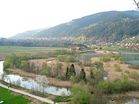
Dolenjske Toplice - Dolnje polje - Straža - Češča vas - Novo mesto
Path length: 14.5 km
Duration of the drive: 1:25 h
Starting point: Dolenjske Toplice
Region: Dolenjska
Otočec - Kostanjevica na Krki
Path length: 21.8 km
Duration of the drive: 1:20 h
Starting point: Otočec
Region: Dolenjska
Otočec - Dolenjske Toplice
Path length: 21.8 km
Duration of the drive: 1:40 h
Starting point: Otočec
Region: Dolenjska
Otočec - Trška gora
Path length: 6.6 km
Duration of the drive: 0:35 h
Starting point: Otočec
Region: Dolenjska
Otočec - Gaberje
Path length: 10.3 km
Duration of the drive: 1:00 h
Starting point: Otočec
Region: Dolenjska
Šentjernej - Kostanjeviška jama
Path length: 8.4 km
Duration of the drive: 0:50 h
Starting point: Šentjernej
Region: Dolenjska
Ratež - Pletarje
Path length: 12.8 km
Duration of the drive: 1:00 h
Starting point: Ratež
Region: Dolenjska
Železniki-Škofja Loka
Path length: 15.0 km
Duration of the drive: 1:10 h
Starting point: Železniki
Region: Gorenjska
Kropa-Dražgoše-Železniki
Path length: 20.0 km
Duration of the drive: 2:30 h
Starting point: Kropa
Region: Gorenjska

Šmarješke Toplice - Grad Otočec
Path length: 10.2 km
Duration of the drive: 0:30 h
Starting point: Šmarješke Toplice
Region: Dolenjska
Otočec - Ratež - Novo mesto
Path length: 12.2 km
Duration of the drive: 0:35 h
Starting point: Otočec
Region: Dolenjska
Novo Mesto - Dolenjske Toplice
Path length: 11.4 km
Duration of the drive: 0:40 h
Starting point: Novo mesto
Region: Dolenjska
Gorenjski trojček
Path length: 116.0 km
Duration of the drive: 5:00 h
Starting point: Lesce
Region: Gorenjska
Krog čez Lučine
Path length: 140.0 km
Duration of the drive: 6:00 h
Starting point: Lesce
Region: Central Slovenia

Memorial Mirka Krakerja
Path length: 38.0 km
Duration of the drive: 1:42 h
Starting point: Kranj
Region: Gorenjska
Mangart - Cerkno - Kranj
Path length: 255.0 km
Duration of the drive: 11:00 h
Starting point: Lesce
Region: Severna Primorska
Krog čez Soriško planino
Path length: 116.0 km
Duration of the drive: 5:00 h
Starting point: Lesce
Region: Gorenjska
Golnik - Globoko
Path length: 58.0 km
Duration of the drive: 2:30 h
Starting point: Lesce
Region: Gorenjska
Vršič
Path length: 13.0 km
Duration of the drive: 1:15 h
Starting point: Kranjska Gora
Region: Gorenjska
Brda 9
Path length: 50.0 km
Duration of the drive: 1:40 h
Starting point: Dobrovo
Region: Severna Primorska
Ig-Želimlje-Ig
Path length: 16.0 km
Duration of the drive: 1:40 h
Starting point: Ig
Region: Central Slovenia
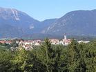
Road biking route Bled-Ravne v Bohinju
Path length: 25.0 km
Duration of the drive: 1:20 h
Starting point: Bled
Region: Gorenjska
Bovec-Kal Koritnica-Čezsoča-Bovec
Path length: 15.2 km
Duration of the drive: 0:00 h
Starting point: Bovec
Region: Severna Primorska
Road biking route Bled - Škofja Loka
Path length: 41.0 km
Duration of the drive: 1:40 h
Starting point: Bled
Region: Gorenjska
Bovec-Plužna-Čezsoča-Bovec
Path length: 18.3 km
Duration of the drive: 0:00 h
Starting point: Bovec
Region: Severna Primorska
Road biking route Kočna
Path length: 16.0 km
Duration of the drive: 1:20 h
Starting point: Jesenice
Region: Gorenjska
Tržič - Kranj
Path length: 16.0 km
Duration of the drive: 0:00 h
Starting point: Tržič
Region: Gorenjska
Z Gorenjske na maraton češenj
Path length: 248.0 km
Duration of the drive: 11:00 h
Starting point: Lesce
Region: Severna Primorska
Bled - Kranj
Path length: 31.0 km
Duration of the drive: 1:30 h
Starting point: Bled
Region: Gorenjska
Podčetrtek-Rogaška Slatina
Path length: 25.0 km
Duration of the drive: 1:10 h
Starting point: Podčetrtek
Region: Savinjska
Podčetrtek-Drensko rebro
Path length: 25.0 km
Duration of the drive: 1:20 h
Starting point: Podčetrtek
Region: Savinjska
Podčetrtek - Zibika - Orehovec - Podčetrtek
Path length: 26.0 km
Duration of the drive: 1:50 h
Starting point: Podčetrtek
Region: Savinjska
Krog okoli Podčetrtka
Path length: 25.0 km
Duration of the drive: 1:40 h
Starting point: Podčetrtek
Region: Savinjska

Z Gorenjske do Kolpe in nazaj
Path length: 345.0 km
Duration of the drive: 14:00 h
Starting point: Lesce (Škofljica)
Region: Central Slovenia
Teharje-Podčetrtek
Path length: 31.0 km
Duration of the drive: 1:20 h
Starting point: Teharje
Region: Savinjska
Z Gorenjske na morje
Path length: 293.0 km
Duration of the drive: 12:00 h
Starting point: Lesce
Region: Južna Primorska
Stari grad-Kamnik
Path length: 4.0 km
Duration of the drive: 1:10 h
Starting point: Kamnik
Region: Central Slovenia
Road biking route Bled-Podnart-Bled
Path length: 40.0 km
Duration of the drive: 1:40 h
Starting point: Bled
Region: Gorenjska
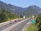
Ob Savi Dolinki
Path length: 95.0 km
Duration of the drive: 4:00 h
Starting point: Lesce
Region: Gorenjska
Jezersko
Path length: 24.0 km
Duration of the drive: 1:30 h
Starting point: Visoko pri Kranju
Region: Gorenjska
Bled - Lesce - Radovljica - Podvin - Otoče - Lipnica - Bled
Path length: 37.0 km
Duration of the drive: 1:20 h
Starting point: Bled
Region: Gorenjska
Pokljuka - Mrzli studenec
Path length: 13.0 km
Duration of the drive: 1:30 h
Starting point: Bled
Region: Gorenjska
Hitro v Grosuplje
Path length: 69.0 km
Duration of the drive: 2:30 h
Starting point: Lesce
Region: Central Slovenia
Bled-Gozd Martuljek-Radovna -Bled
Path length: 71.0 km
Duration of the drive: 3:50 h
Starting point: Bled
Region: Gorenjska
Kamnik - Velenje - Zidani most
Path length: 284.0 km
Duration of the drive: 11:00 h
Starting point: Lesce
Region: Savinjska
Road biking route Savica
Path length: 82.0 km
Duration of the drive: 0:00 h
Starting point: Lesce
Region: Gorenjska
Dolžanova soteska
Path length: 15.5 km
Duration of the drive: 0:50 h
Starting point: Tržič
Region: Gorenjska
Vrbsko jezero
Path length: 225.0 km
Duration of the drive: 9:15 h
Starting point: Lesce
Region: Gorenjska
Rezija
Path length: 227.0 km
Duration of the drive: 10:30 h
Starting point: Lesce
Region: Severna Primorska
Okrog tromeje
Path length: 130.0 km
Duration of the drive: 5:15 h
Starting point: Lesce
Region: Gorenjska
Ljubljana-Vrhnika
Path length: 23.0 km
Duration of the drive: 0:00 h
Starting point: Ljubljana-Dolgi most
Region: Central Slovenia
Bistra
Path length: 23.0 km
Duration of the drive: 0:00 h
Starting point: Ljubljana-Dolgi most
Region: Central Slovenia
Road biking route Čez Pokljuko v Bohinj
Path length: 70.0 km
Duration of the drive: 0:00 h
Starting point: Lesce
Region: Gorenjska
Road biking route Krog čez Podhom
Path length: 44.0 km
Duration of the drive: 0:00 h
Starting point: Lesce
Region: Gorenjska
Čez Dobravo
Path length: 30.5 km
Duration of the drive: 1:30 h
Starting point: Lesce
Region: Gorenjska
Orle
Path length: 8.0 km
Duration of the drive: 0:50 h
Starting point: Rudnik
Region: Central Slovenia
Road biking route Bled-Brezje-Radovljica-Bled
Path length: 39.0 km
Duration of the drive: 1:40 h
Starting point: Bled
Region: Gorenjska
Koper-Koštabona
Path length: 12.5 km
Duration of the drive: 1:20 h
Starting point: Koper
Region: Južna Primorska
Kolesarska pot 9
Path length: 45.0 km
Duration of the drive: 45:00 h
Starting point: Kozje
Region: Savinjska
Krog pod gorami
Path length: 39.0 km
Duration of the drive: 1:35 h
Starting point: Lesce
Region: Gorenjska

Kolesarska pot 8
Path length: 34.6 km
Duration of the drive: 0:00 h
Starting point: Prevorje
Region: Savinjska
Kolesarska pot 7
Path length: 24.0 km
Duration of the drive: 30:00 h
Starting point: Gorica pri Slivnici
Region: Savinjska

Na sončni strani Bovca
Path length: 5.4 km
Duration of the drive: 0:00 h
Starting point: Bovec
Region: Severna Primorska
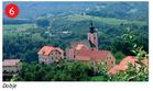
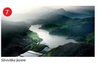
Kolesarska pot 6
Path length: 22.7 km
Duration of the drive: 35:00 h
Starting point: Dobje
Region: Savinjska
Road biking route Krog čez Laze
Path length: 48.0 km
Duration of the drive: 2:10 h
Starting point: Lesce
Region: Gorenjska
Pot zdravja ( Parenzana ) - Porečanka2
Path length: 15.0 km
Duration of the drive: 0:40 h
Starting point: Izola
Region: Južna Primorska
Road biking route Bled - Bohinj
Path length: 55.0 km
Duration of the drive: 2:00 h
Starting point: Bled
Region: Gorenjska
Road biking route Bled-Boh.Bela-Bled
Path length: 23.0 km
Duration of the drive: 1:05 h
Starting point: Bled
Region: Gorenjska
Road biking route Bled-Žirovnica-Radovljica-Lesce-Bled
Path length: 24.0 km
Duration of the drive: 1:05 h
Starting point: Bled
Region: Gorenjska
Kolesarska pot 5
Path length: 37.7 km
Duration of the drive: 1:00 h
Starting point: Planina pri Sevnici
Region: Savinjska
Kolesarska pot 4
Path length: 17.0 km
Duration of the drive: 0:00 h
Starting point: Šentjur
Region: Savinjska
Bovec-Most na Soči
Path length: 50.0 km
Duration of the drive: 0:00 h
Starting point: Bovec
Region: Severna Primorska
Bled-Kropa
Path length: 41.0 km
Duration of the drive: 1:20 h
Starting point: Bled
Region: Gorenjska
Kolesarska pot 3
Path length: 13.5 km
Duration of the drive: 30:00 h
Starting point: Ponikva
Region: Savinjska
Kolesarska pot 2
Path length: 25.5 km
Duration of the drive: 1:00 h
Starting point: Šentjur
Region: Savinjska
Šmarjetna nad Kranjem
Path length: 4.0 km
Duration of the drive: 0:20 h
Starting point: Stražišče pri Kranju
Region: Gorenjska
Kolesarska pot 1
Path length: 42.4 km
Duration of the drive: 2:00 h
Starting point: Dramlje
Region: Savinjska
Janče1
Path length: 13.0 km
Duration of the drive: 1:10 h
Starting point: Podgrad pri Ljubljani
Region: Central Slovenia

Vrhnika - Žiri
Path length: 24.0 km
Duration of the drive: 2:30 h
Starting point: Vrhnika
Region: Central Slovenia
Ob Sori od Medvod do Žirov
Path length: 35.0 km
Duration of the drive: 1:30 h
Starting point: Medvode
Region: Central Slovenia
Kurešček
Path length: 10.0 km
Duration of the drive: 1:20 h
Starting point: Ig
Region: Central Slovenia
Ob Savi od Litije do Ljubljane
Path length: 22.0 km
Duration of the drive: 1:00 h
Starting point: Litija
Region: Central Slovenia
Mošnje-Dobro Polje-Globoko-Radovljica
Path length: 14.0 km
Duration of the drive: 1:00 h
Starting point: Mošnje
Region: Gorenjska
Boh.Bistrica-Soriška Planina
Path length: 13.0 km
Duration of the drive: 2:00 h
Starting point: Boh.Bistrica
Region: Gorenjska
Sv. Primož na Jamniku
Path length: 45.0 km
Duration of the drive: 2:30 h
Starting point: Kokrica
Region: Gorenjska
Bela Krajina 4
Path length: 55.0 km
Duration of the drive: 4:30 h
Starting point: Marindol
Region: Dolenjska
Bela Krajina 8
Path length: 53.0 km
Duration of the drive: 3:30 h
Starting point: Marindol
Region: Dolenjska
Sv. Jošt nad Kranjem
Path length: 18.0 km
Duration of the drive: 1:10 h
Starting point: Kranj
Region: Gorenjska
Idrija - Ledine
Path length: 7.0 km
Duration of the drive: 0:00 h
Starting point: Idrija
Region: Severna Primorska

Proga svetovnega rekorda
Path length: 18.0 km
Duration of the drive: 0:00 h
Starting point: Moravske Toplice
Region: Prekmurje
Čez polja
Path length: 69.0 km
Duration of the drive: 0:00 h
Starting point: Moravske Toplice
Region: Prekmurje
Brda 7
Path length: 26.0 km
Duration of the drive: 0:00 h
Starting point: Dobrovo
Region: Severna Primorska
Brda 6
Path length: 21.0 km
Duration of the drive: 0:00 h
Starting point: Dobrovo
Region: Severna Primorska
Mokra pustolovščina
Path length: 43.0 km
Duration of the drive: 0:00 h
Starting point: Moravske Toplice
Region: Prekmurje
Mala rapsodija
Path length: 22.0 km
Duration of the drive: 0:00 h
Starting point: Moravske Toplice
Region: Prekmurje
Gričevnata zapeljivka
Path length: 18.0 km
Duration of the drive: 0:00 h
Starting point: Moravske Toplice
Region: Prekmurje
Položna zapeljivka
Path length: 19.0 km
Duration of the drive: 0:00 h
Starting point: Moravske Toplice
Region: Prekmurje
Madžarska 2
Path length: 38.0 km
Duration of the drive: 0:00 h
Starting point: Martinje
Region: Prekmurje
Madžarska 1
Path length: 28.0 km
Duration of the drive: 0:00 h
Starting point: Kobilje
Region: Prekmurje
Ravnica 4
Path length: 11.0 km
Duration of the drive: 0:00 h
Starting point: Murska Sobota
Region: Prekmurje
Ravnica 3
Path length: 20.0 km
Duration of the drive: 0:00 h
Starting point: Moravske Toplice
Region: Prekmurje
Ravnica 1
Path length: 19.0 km
Duration of the drive: 0:00 h
Starting point: Ljutomer
Region: Štajerska
Sp. Tuštanj - Brdo
Path length: 40.0 km
Duration of the drive: 0:00 h
Starting point: Domžale
Region: Central Slovenia
Vinska pot
Path length: 20.0 km
Duration of the drive: 1:00 h
Starting point: Ljutomer
Region: Štajerska
Skok v Dražgoše
Path length: 16.0 km
Duration of the drive: 1:00 h
Starting point: Selca
Region: Gorenjska
Okoli Šmarne gore
Path length: 28.0 km
Duration of the drive: 1:15 h
Starting point: Tacen
Region: Central Slovenia
Mali Lipoglav 3
Path length: 4.0 km
Duration of the drive: 0:40 h
Starting point: Grosuplje
Region: Central Slovenia
Mali Lipoglav 2
Path length: 3.0 km
Duration of the drive: 0:30 h
Starting point: Šmarje
Region: Central Slovenia
Mali Lipoglav 1
Path length: 11.0 km
Duration of the drive: 1:30 h
Starting point: Ljubljana-Dobrunje
Region: Central Slovenia
Zgornje Gorje - Blejska Dobrava - Moste - Bled
Path length: 26.0 km
Duration of the drive: 1:20 h
Starting point: Zgornje Gorje
Region: Gorenjska

Termalna
Path length: 130.0 km
Duration of the drive: 0:00 h
Starting point: Gornja Radgona
Region: Štajerska
Haloze-rdeča pot
Path length: 50.0 km
Duration of the drive: 0:00 h
Starting point: Žetale
Region: Štajerska

Haloze-modra pot
Path length: 11.0 km
Duration of the drive: 0:00 h
Starting point: Žetale
Region: Štajerska
Benedikt
Path length: 43.0 km
Duration of the drive: 0:00 h
Starting point: Lenart
Region: Štajerska
Do Zbiljskega jezera
Path length: 30.7 km
Duration of the drive: 1:30 h
Starting point: Šenčur
Region: Gorenjska
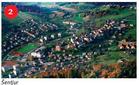
Ravna
Path length: 45.0 km
Duration of the drive: 0:00 h
Starting point: Terme Ptuj
Region: Štajerska

Dolžanova soteska
Path length: 15.0 km
Duration of the drive: 0:50 h
Starting point: Tržič
Region: Gorenjska