


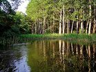
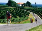
SloveniaHolidays.com > Activities > Cycling > Bicycle touring
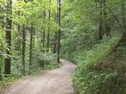
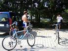
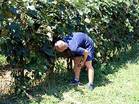
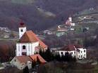
Bicycle touring Slovenia - Cycling
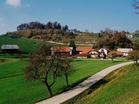
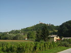
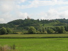
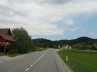
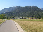
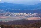
Celjska koča
Path length: 30.0 km
Duration of the drive: 2:00 h
Starting point: TIC Laško
Region: Savinjska

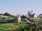
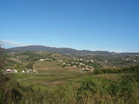
Šentrupert
Path length: 28.0 km
Duration of the drive: 2:00 h
Starting point: TIC Laško
Region: Savinjska

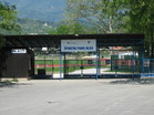
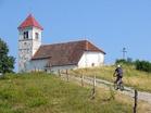
Šmohor
Path length: 28.0 km
Duration of the drive: 2:00 h
Starting point: TIC Laško
Region: Savinjska
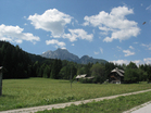
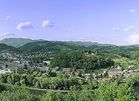
Lisca
Path length: 49.0 km
Duration of the drive: 0:00 h
Starting point: TIC Laško
Region: Savinjska
Trobni Dol
Path length: 45.0 km
Duration of the drive: 3:30 h
Starting point: TIC Laško
Region: Savinjska
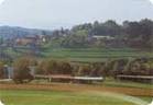
Vrh nad Laškim
Path length: 27.0 km
Duration of the drive: 1:30 h
Starting point: TIC Laško
Region: Savinjska
Junior - Rimske Toplice
Path length: 14.0 km
Duration of the drive: 0:45 h
Starting point: TIC Laško
Region: Savinjska

V dolino Winetou
Path length: 60.0 km
Duration of the drive: 4:45 h
Starting point: Podčetrtek
Region: Savinjska
Na Slivniško jezero
Path length: 41.0 km
Duration of the drive: 2:50 h
Starting point: Podčetrtek
Region: Savinjska
V Virštanj
Path length: 16.0 km
Duration of the drive: 0:50 h
Starting point: Podčetrtek
Region: Savinjska
Na Imensko Gorco
Path length: 12.0 km
Duration of the drive: 1:00 h
Starting point: Podčetrtek
Region: Savinjska
V Svinjski graben
Path length: 11.0 km
Duration of the drive: 0:50 h
Starting point: Podčetrtek
Region: Savinjska
V Podsredo
Path length: 40.0 km
Duration of the drive: 3:35 h
Starting point: Podčetrtek
Region: Savinjska
V Kozje
Path length: 34.0 km
Duration of the drive: 3:00 h
Starting point: Podčetrtek
Region: Savinjska
V Vonarje
Path length: 23.0 km
Duration of the drive: 1:30 h
Starting point: Podčetrtek
Region: Savinjska

V Loko pri Žumsu
Path length: 23.0 km
Duration of the drive: 1:15 h
Starting point: Podčetrtek
Region: Savinjska
Na Jelenov greben
Path length: 12.0 km
Duration of the drive: 0:35 h
Starting point: Podčetrtek
Region: Savinjska
V Zibiko
Path length: 23.0 km
Duration of the drive: 2:00 h
Starting point: Podčetrtek
Region: Savinjska
Brda 8
Path length: 33.0 km
Duration of the drive: 2:30 h
Starting point: Dobrovo
Region: Severna Primorska
Bled - Radovljica - Kašarija - Lesce - Bled
Path length: 24.0 km
Duration of the drive: 1:10 h
Starting point: Bled
Region: Gorenjska
Dom v Tamarju
Path length: 23.0 km
Duration of the drive: 1:30 h
Starting point: Kranjska Gora
Region: Gorenjska
Krog po stranskih poteh
Path length: 38.0 km
Duration of the drive: 2:00 h
Starting point: Lesce
Region: Gorenjska
Sv. Ana
Path length: 12.0 km
Duration of the drive: 1:00 h
Starting point: Rudnik
Region: Central Slovenia
Sevniška kolesarska pot
Path length: 97.0 km
Duration of the drive: 0:00 h
Starting point: Sevnica
Region: Zasavsko – Posavska
Krožna trasa
Path length: 55.0 km
Duration of the drive: 0:00 h
Starting point: Športni park Domžale
Region: Central Slovenia
Velika pustolovščina
Path length: 61.0 km
Duration of the drive: 0:00 h
Starting point: Moravske Toplice
Region: Prekmurje
Sončna cesta
Path length: 56.0 km
Duration of the drive: 0:00 h
Starting point: Moravske Toplice
Region: Prekmurje
Velika rapsodija
Path length: 51.0 km
Duration of the drive: 0:00 h
Starting point: Moravske Toplice
Region: Prekmurje
Energijska dogodivščina
Path length: 45.0 km
Duration of the drive: 0:00 h
Starting point: Moravske Toplice
Region: Prekmurje
Jeruzalem 3
Path length: 6.0 km
Duration of the drive: 0:00 h
Starting point: Vuzmetinci
Region: Štajerska

Jeruzalem 2
Path length: 6.0 km
Duration of the drive: 0:00 h
Starting point: Jeruzalem
Region: Štajerska
Goričko 3
Path length: 31.0 km
Duration of the drive: 0:00 h
Starting point: Domajinci
Region: Prekmurje
Goričko 2
Path length: 55.0 km
Duration of the drive: 0:00 h
Starting point: Cankova
Region: Prekmurje
Goričko 1
Path length: 68.0 km
Duration of the drive: 0:00 h
Starting point: Radenci
Region: Štajerska
Ravnica 2
Path length: 29.0 km
Duration of the drive: 0:00 h
Starting point: Srednja Bistrica
Region: Prekmurje
Jeruzalem
Path length: 20.0 km
Duration of the drive: 0:00 h
Starting point: Ljutomer
Region: Štajerska
Slovenske gorice 1
Path length: 50.0 km
Duration of the drive: 0:00 h
Starting point: Radenci
Region: Štajerska
Slovenske gorice 2
Path length: 14.0 km
Duration of the drive: 0:00 h
Starting point: Radoslavci
Region: Štajerska
Vinje - Zg. Javoršica
Path length: 35.0 km
Duration of the drive: 0:00 h
Starting point: Domžale
Region: Central Slovenia
Homec - Groblje
Path length: 30.0 km
Duration of the drive: 0:00 h
Starting point: Domžale
Region: Central Slovenia
V zavetju Lubnika 1
Path length: 44.0 km
Duration of the drive: 2:30 h
Starting point: Škofja Loka
Region: Gorenjska
V Vinharje
Path length: 24.0 km
Duration of the drive: 1:30 h
Starting point: Poljane-Hotovlja
Region: Gorenjska
Čez Pasjo ravan
Path length: 137.0 km
Duration of the drive: 6:20 h
Starting point: Lesce
Region: Gorenjska
Path length: 48.0 km
Duration of the drive: 5:00 h
Starting point: Postojna, Hotel Sport
Region: Notranjska
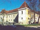
Grajska
Path length: 57.0 km
Duration of the drive: 4:00 h
Starting point: Postojna, Hotel Sport
Region: Notranjska
Bela Krajina 3
Path length: 50.0 km
Duration of the drive: 4:00 h
Starting point: Marindol
Region: Dolenjska
Bela Krajina 2
Path length: 40.0 km
Duration of the drive: 3:30 h
Starting point: Marindol
Region: Dolenjska
Mali blejski krog
Path length: 30.0 km
Duration of the drive: 2:00 h
Starting point: Bled
Region: Gorenjska
Med sadovnjaki in vinogradi
Path length: 39.0 km
Duration of the drive: 2:00 h
Starting point: Moravske Toplice
Region: Prekmurje
Osrednja pot
Path length: 64.0 km
Duration of the drive: 3:20 h
Starting point: Puconci
Region: Prekmurje
Panoramska pot
Path length: 38.0 km
Duration of the drive: 2:10 h
Starting point: Cankova
Region: Prekmurje
Obmejna pot
Path length: 36.0 km
Duration of the drive: 1:40 h
Starting point: Grad
Region: Prekmurje
S sožitjem ver
Path length: 51.0 km
Duration of the drive: 2:30 h
Starting point: Hodoš
Region: Prekmurje
Po poti kulturne dediščine
Path length: 10.0 km
Duration of the drive: 0:30 h
Starting point: Žirovnica
Region: Gorenjska
Na Cerkljanski vrh, Ermanovec in Slajko
Path length: 30.0 km
Duration of the drive: 2:15 h
Starting point: Hotavlje
Region: Gorenjska
V Davčo k Davčarjem
Path length: 35.0 km
Duration of the drive: 2:30 h
Starting point: Zali Log
Region: Gorenjska
Po stari Blegoški cesti
Path length: 41.0 km
Duration of the drive: 2:20 h
Starting point: Škofja Loka - Mestni trg
Region: Gorenjska
K Sv. Ožboltu nad Škofjo Loko
Path length: 22.0 km
Duration of the drive: 1:30 h
Starting point: Škofja Loka-Puštal
Region: Gorenjska
Čepulje, Križna Gora
Path length: 26.0 km
Duration of the drive: 1:40 h
Starting point: Škofja Loka
Region: Gorenjska

Agatina kolesarska povezava
Path length: 45.0 km
Duration of the drive: 0:00 h
Starting point: Hrastovec
Region: Štajerska
Okoli Pesnice
Path length: 42.0 km
Duration of the drive: 0:00 h
Starting point: Pesnica
Region: Štajerska
Močvirska kolesarska povezava
Path length: 36.0 km
Duration of the drive: 0:00 h
Starting point: Grad v Slovenski Bistrici
Region: Štajerska
Jantarna kolesarska povezava
Path length: 54.0 km
Duration of the drive: 0:00 h
Starting point: Šentilj
Region: Štajerska
Dravska kolesarska povezava
Path length: 99.0 km
Duration of the drive: 0:00 h
Starting point: Dravograd
Region: Koroška
Gorca
Path length: 30.0 km
Duration of the drive: 0:00 h
Starting point: Podlehnik
Region: Štajerska
Krožna
Path length: 120.2 km
Duration of the drive: 0:00 h
Starting point: Trebnje
Region: Dolenjska
Obdravska
Path length: 48.0 km
Duration of the drive: 0:00 h
Starting point: Terme Ptuj
Region: Štajerska
Razgledna
Path length: 42.0 km
Duration of the drive: 0:00 h
Starting point: Terme Ptuj
Region: Štajerska