


SloveniaHolidays.com > Activities > Konjščica
Konjščica


Starting point: Ribčev Laz
- Path length :
31.0 km - Time:
03:45:00 - Difficulty:
Very hard - Ground:
Asphalt, Macadam, Forest path, Cart track - Altitude difference:
908 m
Description of path
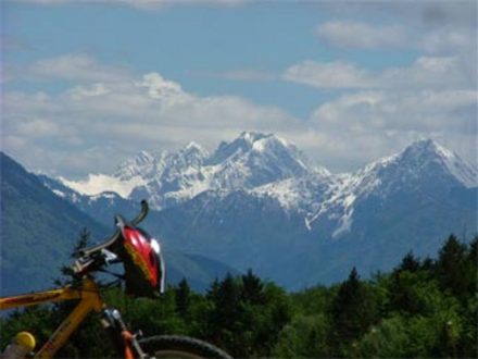
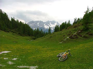
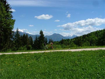
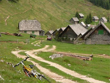
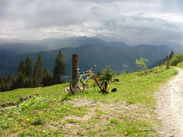
Starting in Ribčev Laz (530m above sea level), we cross the bridge, heading past St. John church and onward to Stara Fužina (540m) . In the village, we cross the bridge and continue in the direction of Srednja vas. After approximately 1,5 kilometers (at 565m above sea level), we turn onto the road heading left near the signpost pointing toward Studor. Heading through the village, we reach the paved road leading to Uskovnica. After taking a sharp turn right, we begin a moderate ascent up a wide, paved forest road. The last part is a little steeper and is marked by several long curves. At 1020m above sea level, the road levels out. From there, we continue over a level road and a few short inclines to the cottages on Lom (1070m), where we turn right onto a somewhat poorer forest road. After a few short, steep sections we ascend past the Uskovnica mountain hut (1154m) to the end of the road at a grassy clearing next to a stream (1175m). We continue straight along a dirt track up a long and very steep incline (ascents V5 and V6). After the incline, the track becomes level once more and continues past the dwellings on Kovce (1270m) to an intersection, where we turn left onto a marked road (the right road leads to a large meadow). At that point, the track becomes rocky. Because of this, two short slopes are unsuitable for cycling – it is necessary to dismount and walk for about two minutes. The final part of the ascent, through a forest, is steep, but quite suitable for cycling. After leaving the forest, we continue along a track leading through grasslands to the dwellings on the Konjščica mountain (1438m).
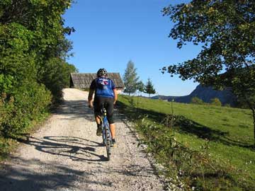
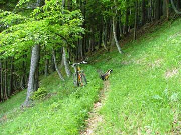
Our descent is down a marked road along the Ribnica stream. Just beyond the dwellings, it is necessary to cross a stream and take the path into the forest. Dismounting, we continue to the beginning of a dirt track (10 minutes of carrying and/or pushing the bicycle along an occasionally steep and rocky path). After reaching the track, we take it (S4 and parts of S5) to the beginning of a forest road and a parking lot (1340m) beneath Miškovec. After cycling along the lightly ascending road for about a kilometer, we turn right at the first intersection (1310m) in the direction of Uskovnica (the road to the left goes to Rudno polje). From here, the road descends slightly to another intersection (1230m), where we turn right (the road to the left goes, again, to Rudno polje). A couple of dozen meters further (1225m), we turn right once again (the road goes straight to Goreljek). Surprise, surprise! Shortly afterwards, we come to yet another intersection, where we go straight (the road to the right goes to Uskovnica). After a light descent, we reach the Na Šehu mountain (1090m), where we pass the first dwellings (which are on the right) and reach an intersection with two dirt tracks. The track on the left is covered with grass and barely noticeable, whereas the one on the right is visibly used. Here, we turn off the road (which goes past a »no traffic« sign straight forward to a number of cottages) onto the aforementioned right track. This track goes across a field of grass to a cottage on the left. After continuing along the cottage for a few meters, we come to another path. Be careful, however, as the path is difficult to see. Assuming you've managed to find it, turn right onto it and descend across the field (in a southwesterly direction) into the forest. The path goes through the trees and eventually reaches a dirt track which intersects the path at a right angle. Here, we turn left onto the dirt track and begin a steep, rocky, and very difficult descent (S6 and parts of S7) down the abandoned dirt track into the Ribnica valley. Be especially careful during the second half of this descent, as it is very technically demanding and will require occasional dismounting. At the end of the dirt track, we continue along the road leading along the left bank of the Ribnica river into Srednja vas (583m). From here, we cycle down an asphalt road through Stara Fužina and back to where we started – Ribčev Laz.
Warning
The author of these pages takes no responsibility for the described cycle routes or for the accuracy of the data. We have presented the cycle routes to the best of our ability, but the cyclist and the maintainer of the route are ultimately responsible for the safety of the trip.